- 580 Posts
- 167 Comments
Joined 1 year ago
Cake day: June 24th, 2023
You are not logged in. If you use a Fediverse account that is able to follow users, you can follow this user.

 3·1 day ago
I’m sure there are a lot of folk that would appreciate and be very interested in any contributions you make, where you could shine a light on the many gaps there are in their understanding. It’s probably not something you can measure in counting lots of upvotes on particular, but I’m pretty sure there is an audience out there for you… Go for it whenever you see feature in any of the raw images or breaking down the results of a paper…
they’re not fun.
100% agreed… Ingenuity should still be gathering data and the occasional images down in Neretva Vallis. Weather permitting it should do that for many years to come. A severe dust storm could dramatically reduce the output from its small solar array to a point where its heaters would not have sufficient power to prevent damage to its batteries and sensitive electronics.
Thats pretty rad.
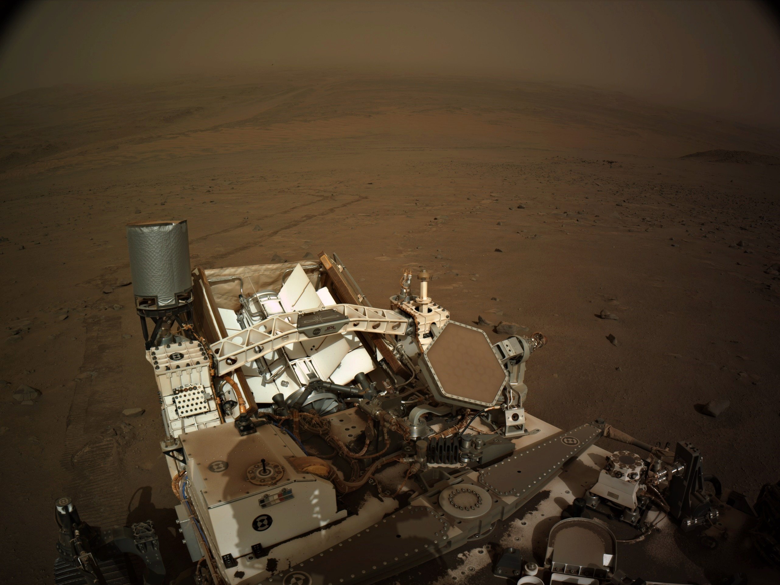
It is a very special view, but if not for the regional dust storm we are experiencing, we’d have a clear view of the crater floor where we landed and some of the areas we visited since landing. We’d even be able to see the Mars helicopter with the MastCam-Z cameras, granted it would only be a a few pixels across as it’s close to 2 kilometers away (1.23 miles) still sat atop a sandy ripple in Neretva Vallis :) I hope the dust storm subsides before we drive over the crater rim, as the views will be memorable.
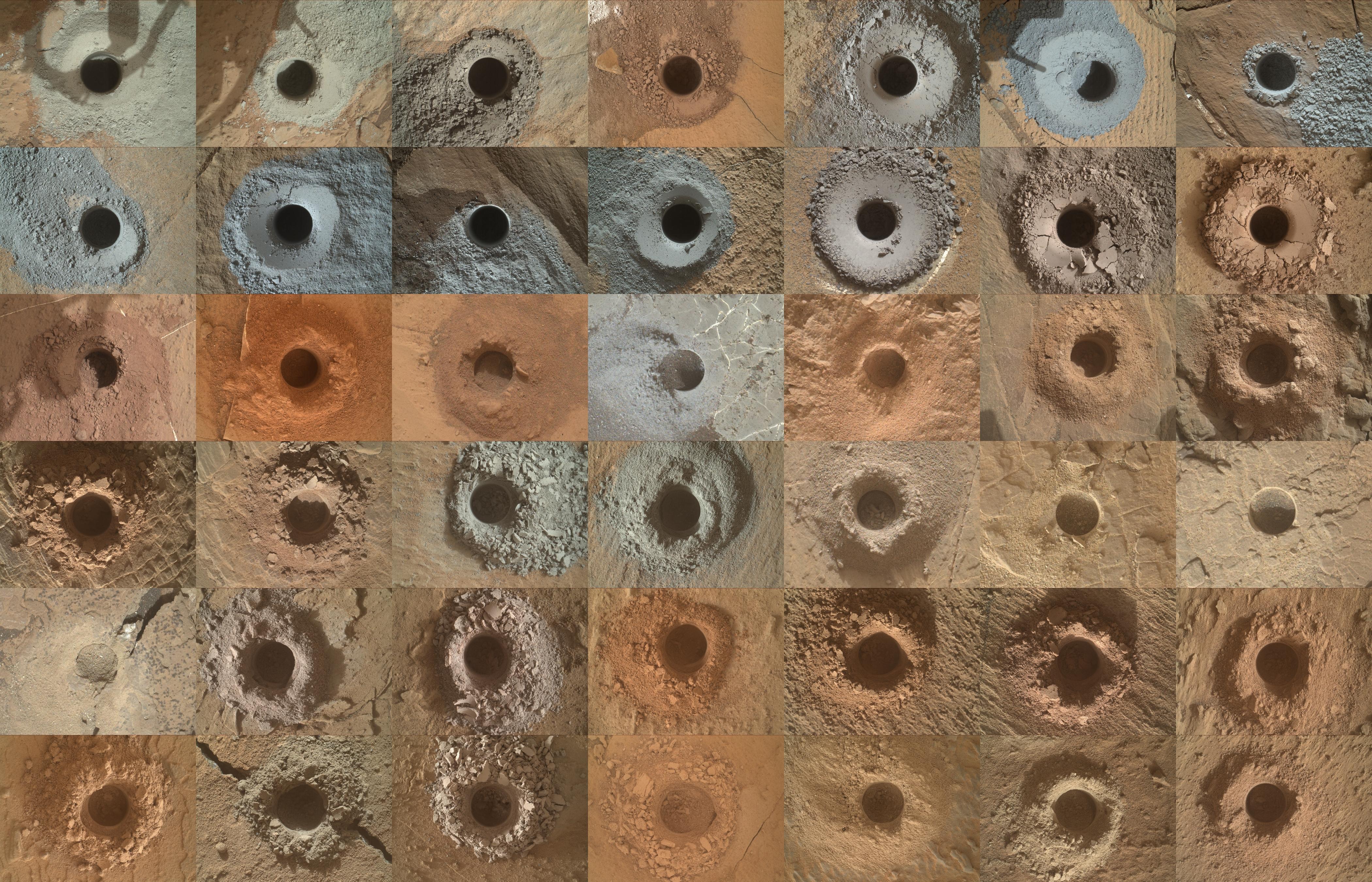
I’d love to be a fly on the wall at the meetings between the science teams on which rocks to investigate. There must be disagreements between the scientists :) I guess we would have only travelled a few hundred meters if they stopped at every rock / target that looked interesting to one of the team, instead of the 32.51 km (20.20 miles) we have traversed. As for the colour, I like to look at the colour of the tailings when they drill holes, there are many gray rocks, but quite a few reddish ones as well. This illustrates it well for me (all 42 sample holes) https://photojournal.jpl.nasa.gov/jpeg/PIA26403.jpg
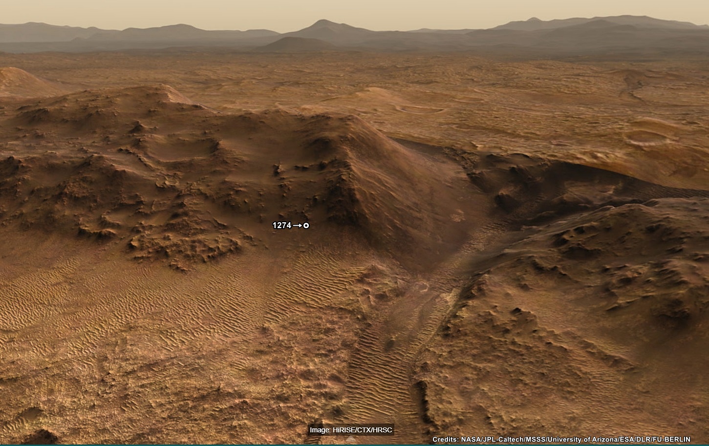
It was, the climb on 1274 currently holds second place on the leader board, the highest elevation climb in a single drive is currently 26.4 meters (sol 1268), but that was over a marginally longer traverse, so probably a very similar average angle. I agree that the team have appeared to pause the drives whenever they spot an enticing target of opportunity :)
Pity we don’t get frequent and detailed mission updates (Like we get on MSL). The PDS mission manager reports are amazing, but they are only made public at least 6 months after the ‘event’
That’s the one 🤣🤣🤣
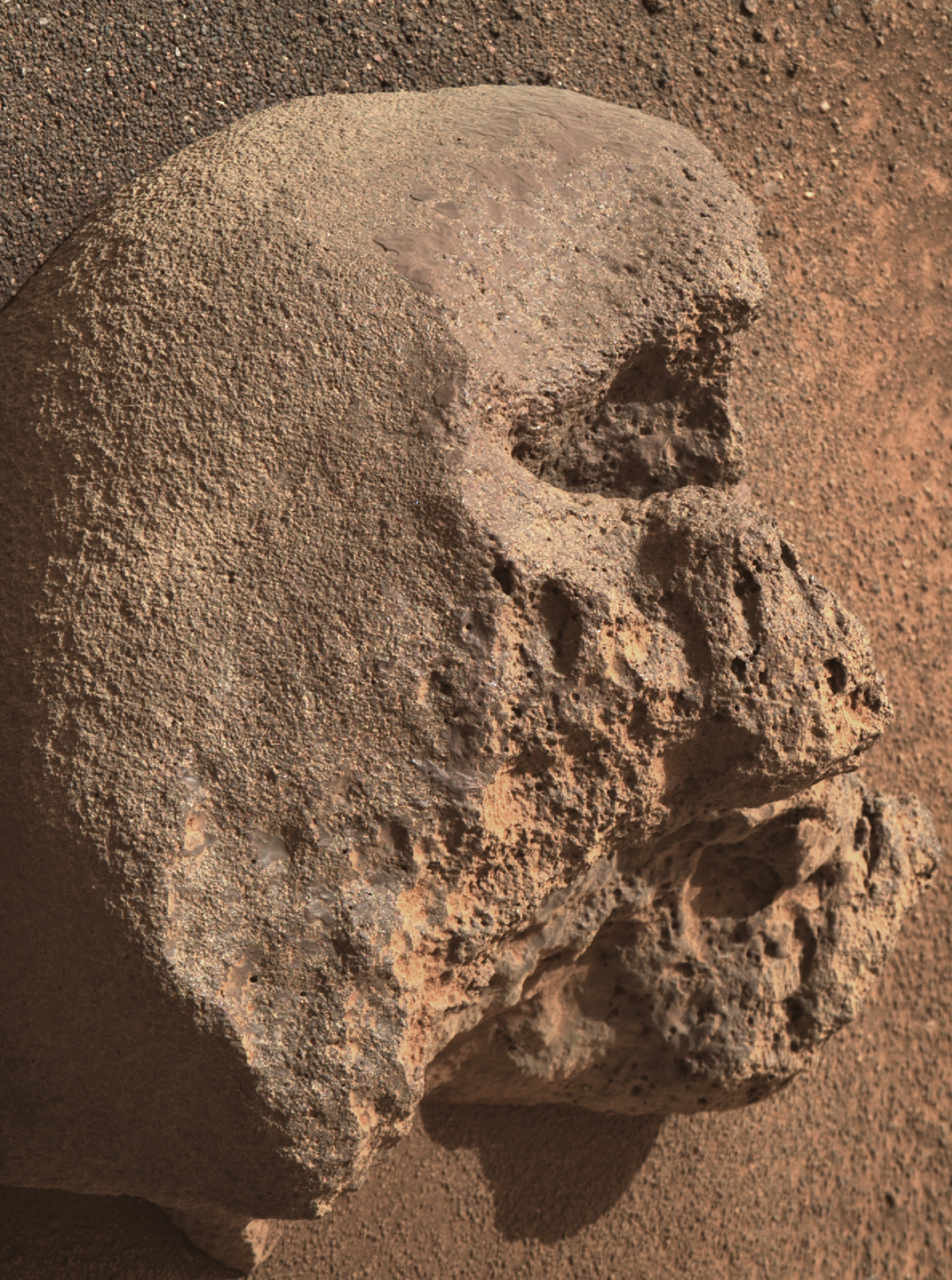
Looking at the camera elevation and the 110mm zoom, I’d have to assume it was a very small
skullrock on Mars ;)
BattleBots on Mars :)
MG seems to like click bait titles for his YT videos. I try to ignore the titles so I can enjoy the content :)
Hopefully we’ll see more funding on Earth to research on similar coatings that occur here on Earth
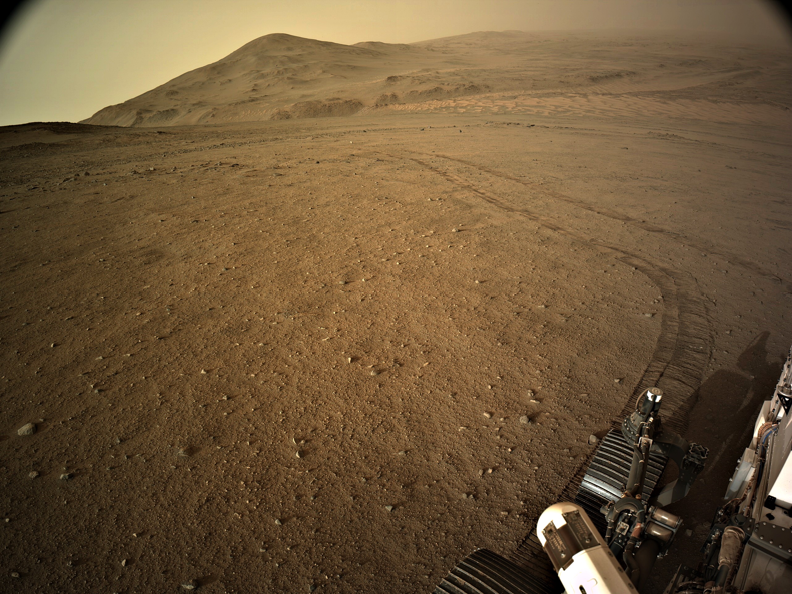
And all the low-lying terrain in this image was under water…
See post (just posted) for the estimated extent of the Paleo Lake : https://lemmy.world/post/19643561
Is that tire patterns in the top left corner?
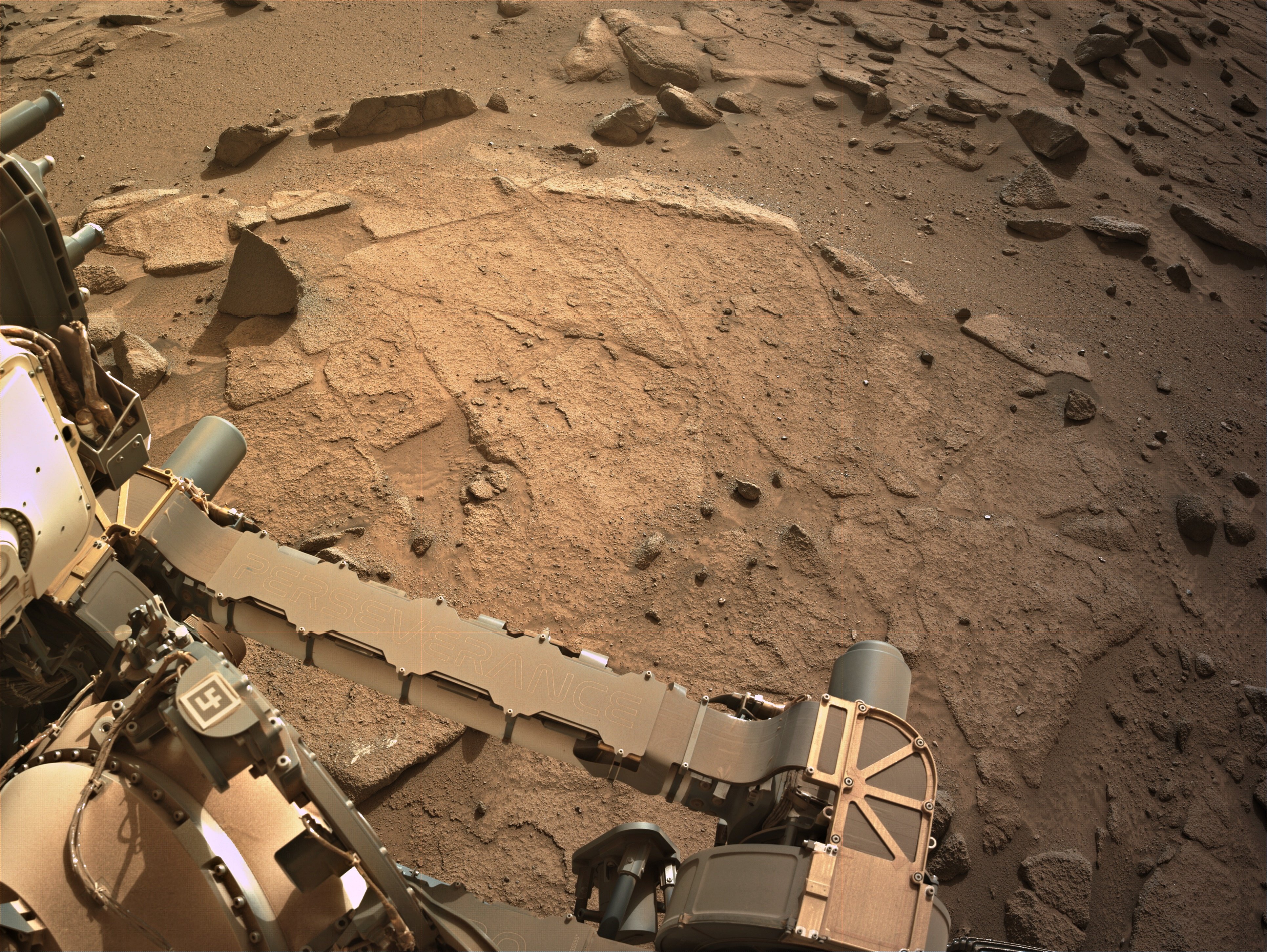
They are small ripples in the soft sand between rocks, if you look in the NavCam images of the workspace on sol 1254 you can see many more examples.
These ripples are formed by the wind (aeolian process).
I personally don’t care about long winded posts, I think you’ll find those that are seeking a deeper understanding will not care either. There will always be those who will want a TLDR post, but you can leave that to others to condense :)
Look forward to your posts (whenever you have time) :)
point-to-point 1419.73 meters (using the coordinates), but a tad further as the rover is climbing the rim now.
The rover is now 101.06 meters higher than the rover and that adds 0.27 meters to the point to point distance which is 1420.0 meters :)
The point-to-point distance between the helicopter and the rover at the locations shown on this image is 1419.7 meters (4657.7 feet)
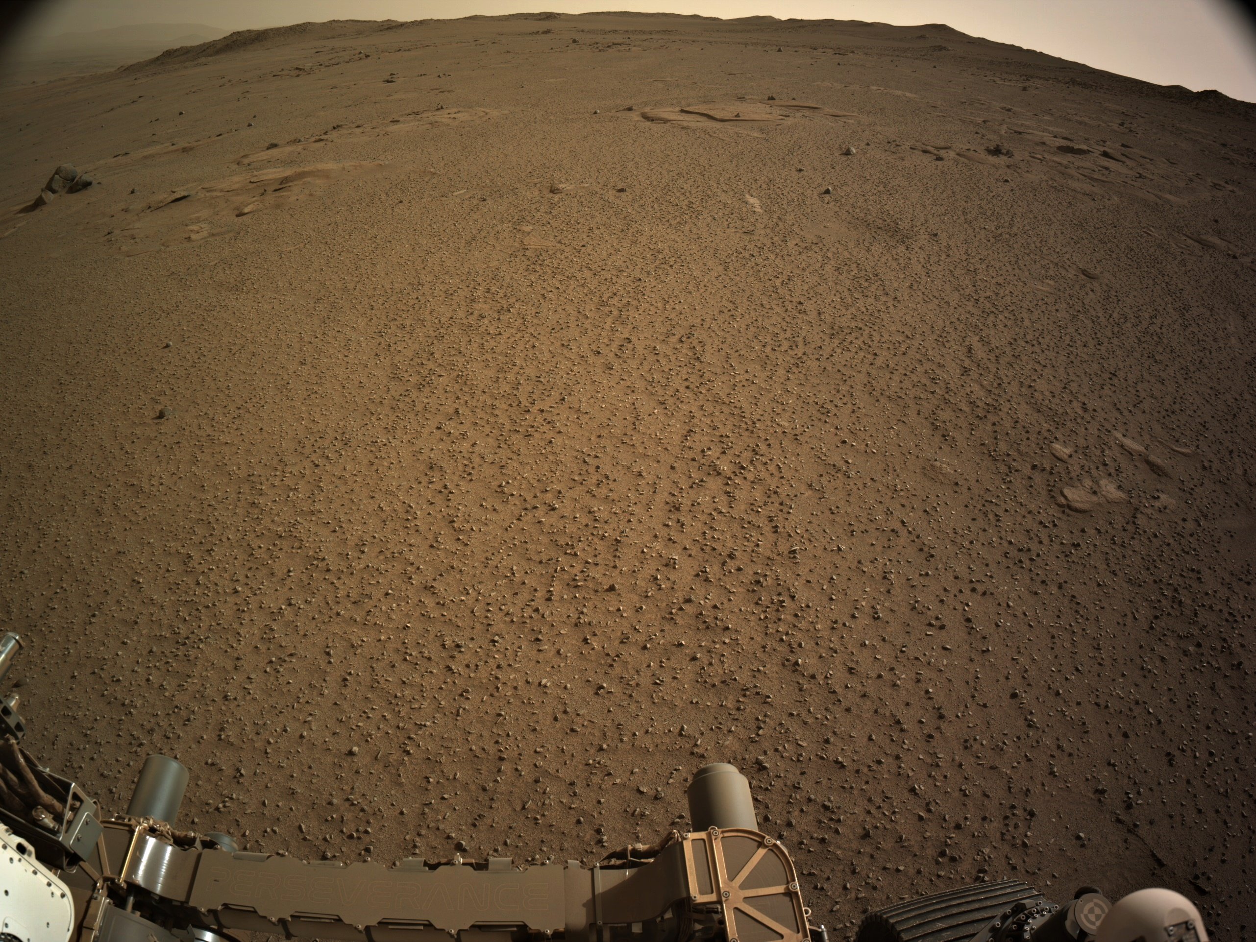
The crater rim rises to a max of 590 meters from the floor of Neretva Vallis that carves through the rim. But the rover has options to cross the rim at a little less than that depending on conditions encountered on the traverse. It’s a steep climb with sections around 23% slope angel.
Love it when knowledgeable folk join the chat :) It takes these posts to a whole new level :)
I’m not a geologist, but from what I understand the red colour is a good indicator of iron and oxygen at the time the sediments were laid down.
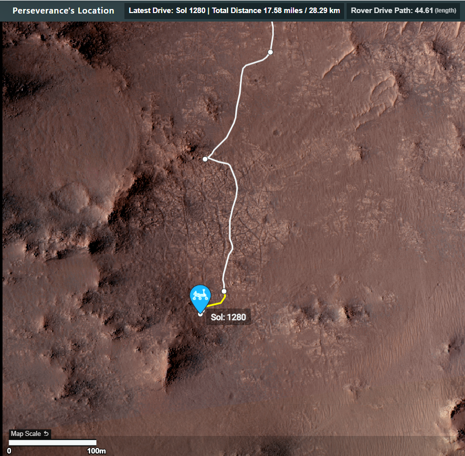
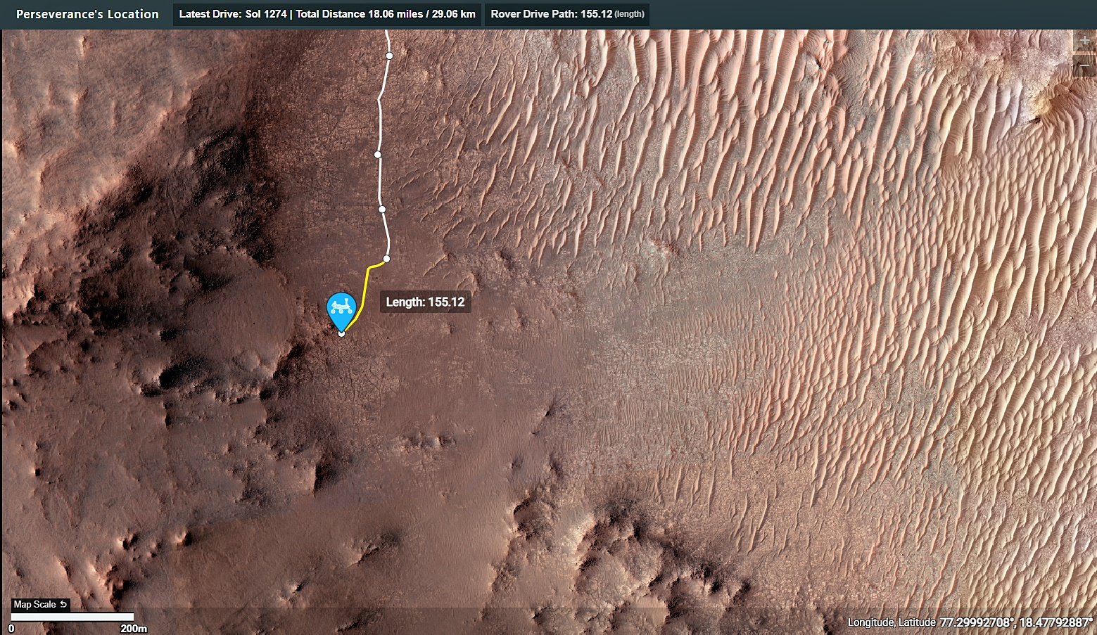
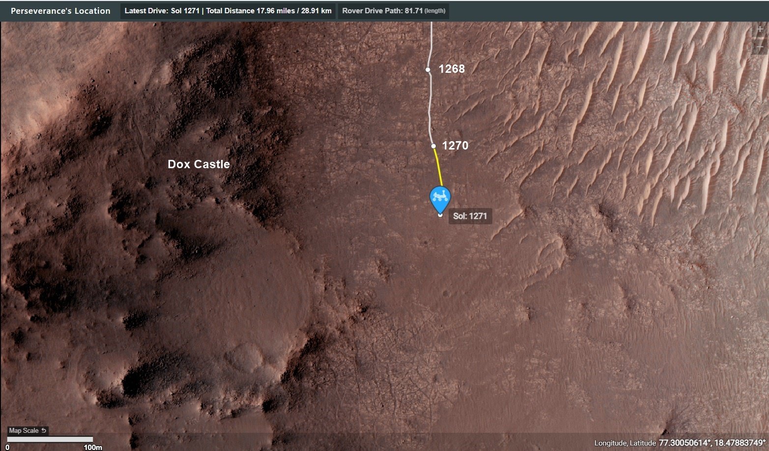
The current location is Serpentine Rapids in the upper right of the map (North is up)
The route (shown in blue) that the agency’s Perseverance Mars rover is expected to take as it climbs up the western rim of Jezero Crater is superimposed on this image taken by the HiRISE camera aboard NASA’s Mars Reconnaissance Orbiter.
At upper right is “Serpentine Rapids,” the final geologic location of interest for the Perseverance science team before the rover begins its ascent. “Dox Castle” is a region the science team would like to explore during the rover’s ascent. Two of the first regions the science team wants study at the top of the crater are “Pico Turquino” and “Witch Hazel Hill.”
Imagery from NASA’s Mars orbiters indicates that Pico Turquino contains ancient fractures that may have been caused by hydrothermal activity in the distant past. Orbital views of Witch Hazel show layered materials that likely date from a time when Mars had a very different climate than today. Those views have revealed light-toned bedrock similar to what was found at “Bright Angel,” the area where Perseverance recently discovered and sampled the “Cheyava Falls” rock, which exhibits chemical signatures and structures that could possibly have been formed by life billions of years ago when the area contained running water.
The distance the rover will drive to get from Serpentine Rapids to the Aurora Park/Pico Turquino area is about 1.1 miles (1.8 kilometers); the change in elevation between the two locations is about 980 feet (300 meters). The distance covered to go from Aurora Park/Pico Turquino to Witch Hazel Hill is about 1.2 miles (2,000 meters) and the change in elevation is about 820 feet (250 meters).
Try zooming in and check out the fringing at the edges of many of those rocks. They are ventifacts, carved by the by wind blown sand over eons. Ventifacts are formed by aeolian processes, hence the title. ☺️
I expect a future book or two when the MSL and 2020 surface operations eventually come to a close. Knowing some of the players I don’t feel they would be overtly controversial. but one may have to read a little between the lines :) Sadly I’m already as old as dirt, so I won’t be seeing them on my coffee table before they nail my pine lid down. As for Neretva Vallis, you are not alone, it seemed more than a little odd that only one sample was taken. I know they have limited tubes left, but it sure feels like a missed opportunity…